
Caribbean on alert as NHC monitors two potential systems

Gavin Riley / Our Today
administrator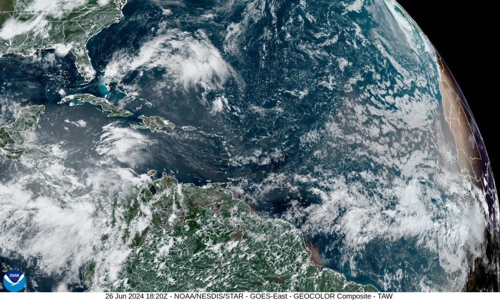
The Miami-based National Hurricane Center (NHC) has put much of the Caribbean on alert as meteorologists surveil two disturbances with mixed chances of strengthening in the coming days.
The NHC, in its tropical weather outlook on Wednesday (June 26), says that the first system is a fast-moving tropical wave over the central Caribbean Sea.
Environmental conditions are somewhat conducive for development, forecasters advised, as the disturbance, designated InvestAL94, produces disorganised shower activity.
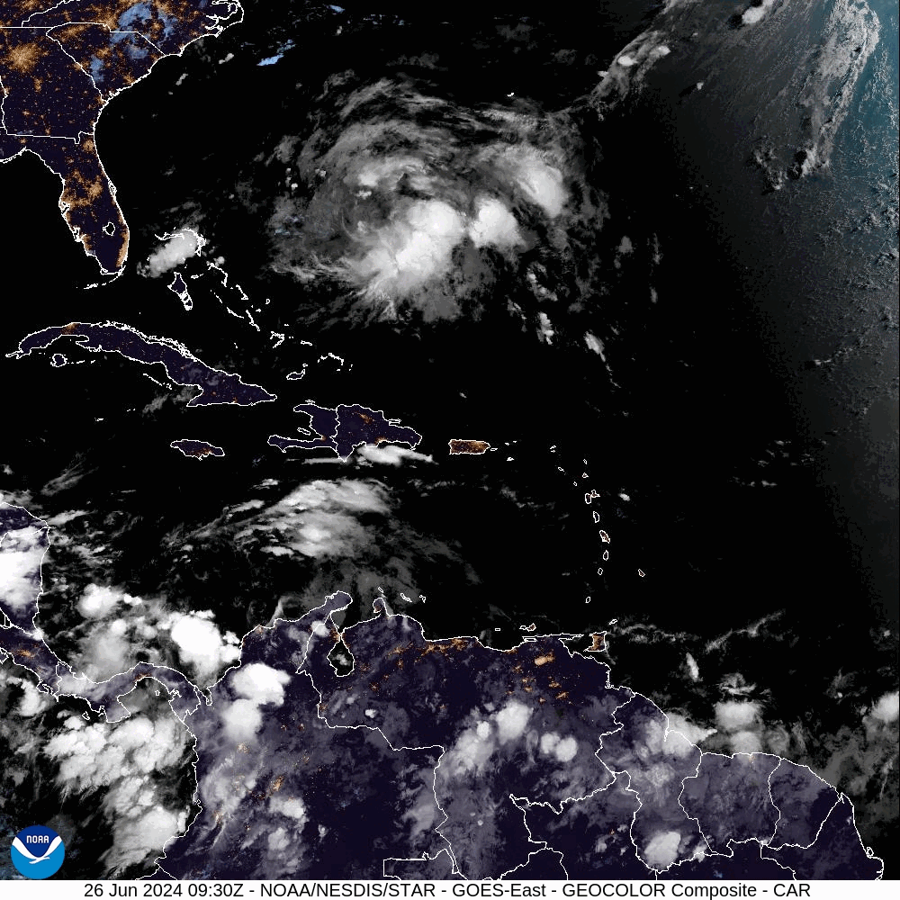
While having to contend with a modern plume of the storm-stunting Saharan Air Layer (SAL), some gradual strengthening is likely as InvestAL94 moves westerly towards the Gulf of Mexico. Formation chances are currently categorised as “low” at 20 per cent in the next seven days.
Farther east, much of the attention is focused on a second tropical wave several hundred miles southwest of the Cabo Verde Islands.
With a “medium” formation chance at 40 per cent over the next seven days, NHC sleuths say that “some development is possible during the next several days, and a tropical depression could form over the tropical Atlantic by the end of the week or this weekend while the system moves westward”.
The system’s development likelihood increased slightly from 30 per cent earlier Wednesday morning.

The next two available names on the 2024 Hurricane Season list are Beryl and Chris.


Comments