Hurricane Larry ‘winning’ battle against Saharan dust, system now expected to weaken

Gavin Riley / Our Today
administratorSome dust creeps into sections of the Caribbean today; Trinidad sounds first alarm
Larry has maintained its dangerous category three strength for several days, but meteorologists at the US-based National Hurricane Center (NHC) expect the massive storm to start gradually weakening.
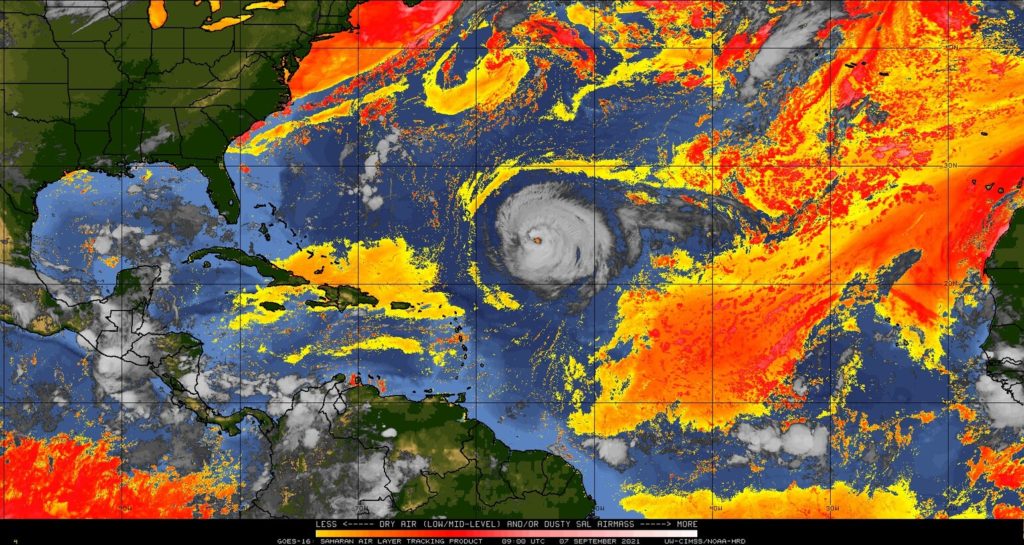
Larry, the third major hurricane of this above-average North Atlantic season, seemed to be ‘winning’ a battle against the dry and unfavourable Saharan Air Layer (SAL).
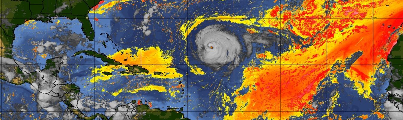
Hurricane Larry is on its fourth day of navigating through a moderately thick plume of Saharan dust in the open Atlantic, as some of the dust clouds begins to re-emerge in sections of the Caribbean on Tuesday (September 7).
According to satellite imagery tracking the SAL, a few patches of the Africa-originating dust is affecting some Caribbean islands in varying degrees.
Particularly in the western side of the archipelago, a thinning layer of Saharan dust has covered much of the Turks and Caicos Islands, Puerto Rico, Hispaniola and Jamaica; with southern Cuba and the southeastern Bahamas also under some of its influence.
The Trinidad and Tobago Meteorological Service (TTMS) has urged citizens to brace for a “significant concentration” of Saharan dust between Wednesday and Thursday.
“This dust event is expected to be relatively short-lived, however, persons who are usually affected are advised to take the necessary precautions,” the TTMS advised.
In the meantime, the NHC continues to insist that Hurricane Larry is not a direct threat to lands in the Caribbean at this time.
According to a 5:00 am Atlantic Standard Time (AST) bulletin, the centre of Hurricane Larry was located near latitude 23.8 North, longitude 55.1 West—or roughly 1,340 kilometres southeast of Bermuda.
The massive system is quietly roaring northwest at 17 kilometres/hour, packing maximum sustained winds of 195 kilometres/hour with higher gusts. While still at Category 3 strength, Larry is marginally weaker than the day prior, when maximum winds reached 201 kilometres/hour, with higher gusts.
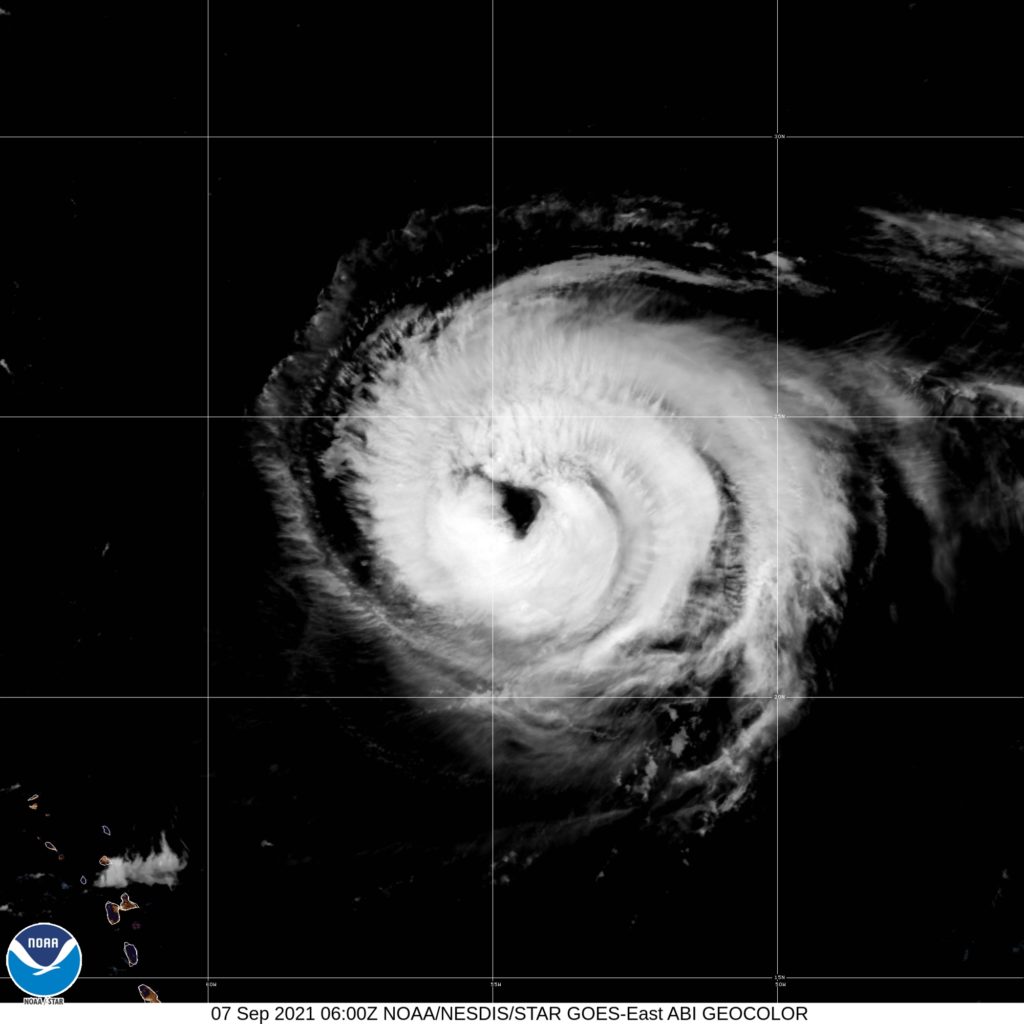
Hurricane-force winds extending outward up to 110 kilometres from Larry’s centre, while tropical-storm-force winds extend outward up to 295 kilometres, the NHC added.
So far, the only indirect hazard posed by Hurricane Larry is dangerous swells, which the NHC warned could cause life-threatening surf and rip current conditions.
Swells are anticipated to continue to affect sections of the Lesser and Greater Antilles through mid-week and Bermuda by the end of the week.
“Significant swells should reach the east coast of the United States and Atlantic Canada by midweek and continue affecting these shores through the end of the week,” the Miami-headquartered hurricane watchdog indicated.
What’s more, interests in Bermuda are encouraged to monitor the progress of Hurricane Larry, as its first tropical storm watch could be required for the island today.


Comments