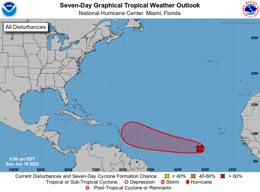

The Eastern Caribbean will remain increasingly vigilant in the coming days as a tropical wave southwest of the Cabo Verde Islands starts to better organise itself in warm Atlantic waters.
In anticipation of a rare developed system in June, the National Hurricane Center (NHC) has again upgraded formation chances to ‘high’ at 80 and 90 per cent respectively over the next two-to-seven days.
“Showers and thunderstorms continue to show signs of organisation in association with a tropical wave located several hundred miles southwest of the Cabo Verde Islands. Environmental conditions appear conducive for additional development, and a tropical depression is likely to form over the next day or two. This system is expected to move westward at 15 to 20 miles/hour across the eastern and central tropical Atlantic through the middle part of the week,” the NHC advised.
Bret is the next available name in the 2023 Hurricane Season.
Computer-simulated models of Invest92-L have shifted further south in the last 24 hours, fuelling uncertainty as the ‘centre cone’ is puts the disturbance on a collision with Barbados and Grenada.

Stay tuned for further updates.


Comments