NHC monitors first potential system of 2025 Hurricane Season

/ Our Today
administrator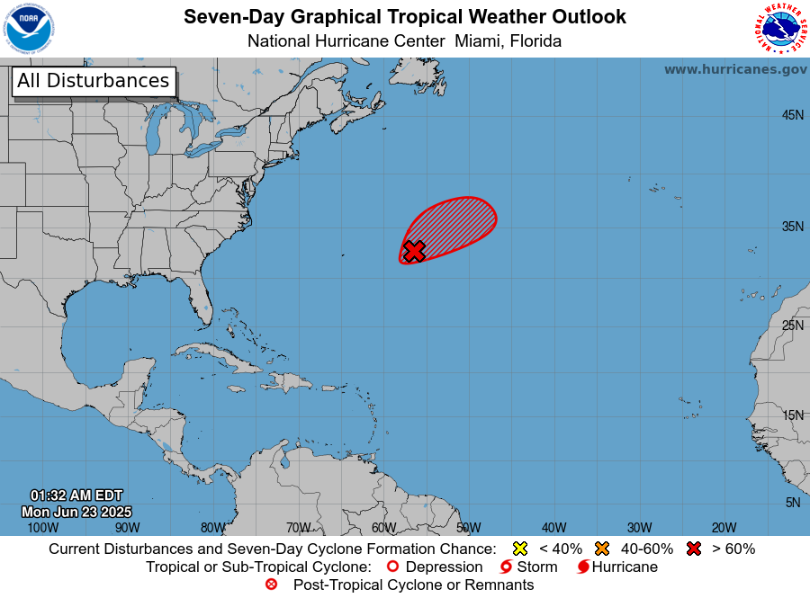
The US-based National Hurricane Center (NHC) on Monday (June 23) is actively monitoring four disturbances in the Atlantic Basin, one of which meteorologists say has somewhat organised overnight.
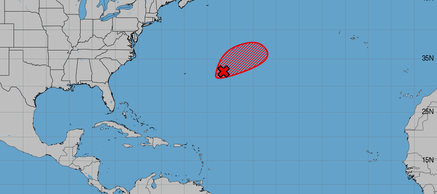
As at 2:00 am Eastern Daylight Time (EDT), an area of low pressure located roughly 805 kilometres (500 miles) east of Bermuda has since been designated Invest AL90.
The NHC, in its first tropical weather outlook for the 2025 Hurricane Season, projected Invest AL90 to strengthen into a “short-lived” tropical depression or storm as early as Monday evening.
Invest AL90, with formation chances listed at a “high” 70 per cent likelihood in the next two to seven days, is then expected to encounter less favourable environmental conditions come Tuesday, “ending its opportunity for further development”.
“Recent satellite-derived wind data also indicates the system has a well-defined surface circulation with maximum sustained winds of 30-35 [miles/hour]. While environmental conditions are only marginally favourable, only a small increase in organisation and persistence of the current shower and thunderstorm activity is likely to result in the formation of a short-lived tropical depression or storm, as soon as later today,” the NHC forecasted.
Weather sleuths anticipate the disturbance will continue on a northeastern movement, with no immediate threat to land over the open central Atlantic Ocean.
Andrea is the first name for this year’s hurricane season, which, three weeks in, is off to one of the slowest starts in 20 years, according to the New York Times.


Comments