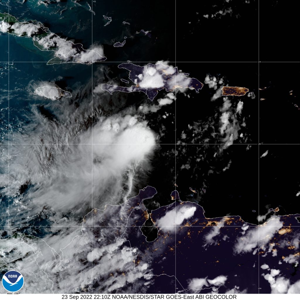
The Jamaica Meteorological Service has today (September 23) discontinued the severe weather alert and activated a tropical storm watch ahead of the fallout from Tropical Depression Nine in the southern Caribbean Sea.
The Met Service, in an advisory this evening, told Jamaicans to brace for gradually deteriorating weather conditions as early as Saturday morning.
“A tropical storm watch means that tropical storm conditions pose a possible threat to Jamaica within the next 48 hours. Rainfall will increase during the day and is likely to be accompanied by gusty winds by Saturday night,” the Met Service indicated.
The disturbance—beaten to the name ‘Hermine’ by Tropical Depression Ten off the Cabo Verde Islands—is still expected to strengthen into Tropical Storm Ian by tonight.
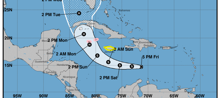
Meanwhile, the Cayman Islands National Weather Service has activated a hurricane watch for the British Overseas Territory as the main island Grand Cayman anticipates a direct hit on Monday.
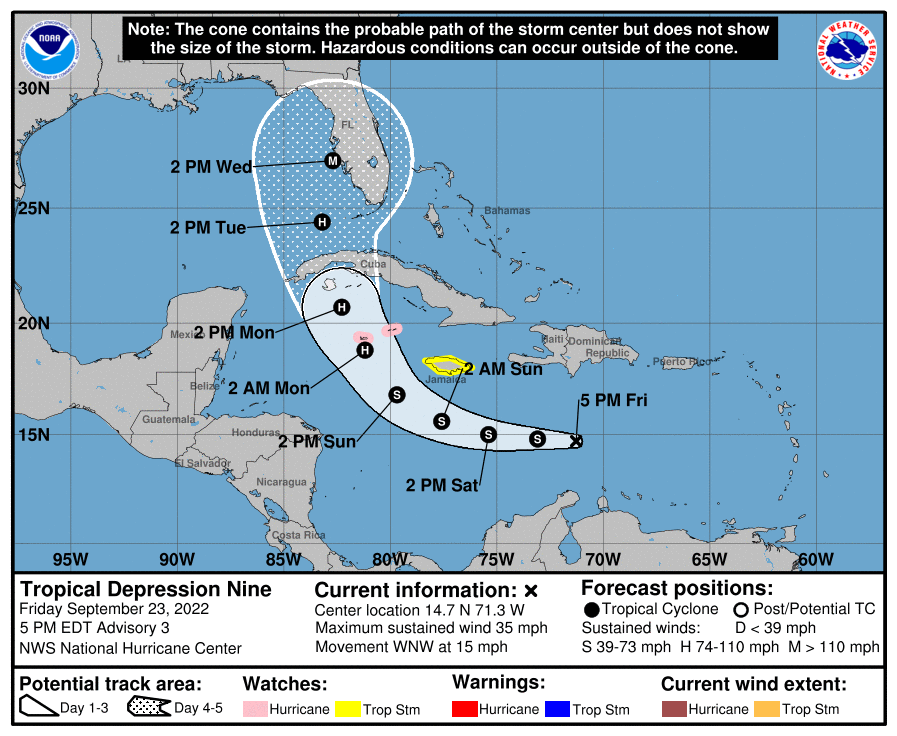
Should the system maintain its current trajectory, the Caymanian agency advised: “Overcast skies with widespread thunderstorms are expected from Sunday as the system nears the Cayman Islands. Hurricane-force winds are likely for Grand Cayman. Extremely rough seas accompanied by storm surges and also expected.”
Both territories will face the brunt of TD Nine, with respective hurricane- and tropical-storm-force winds as well as isolated rainfall maximums of 12 inches. Western and central Cuba, which are expected to also get directly hit by a hurricane intensity Ian, could see up to 14 inches of torrential rainfall.
Sleuths at the Miami-based National Hurricane Center (NHC) further warned Cuba and Jamaica are at elevated risk of flash flooding and mudslides, particularly in areas of higher terrain.
According to the NHC, the centre of Tropical Depression Nine was located near latitude 14.7 North and longitude 71.3 West—or roughly 690 kilometres east-southeast of Kingston.
The depression is now accelerating near 24 kilometres/hour on a west-northwest movement over the southern Caribbean Sea. TD Nine currently packs maximum sustained winds at 55 kilometres/hour, with higher gusts and is forecasted to slowly strengthen over the next 48 hours before entering a rapid intensification phase.
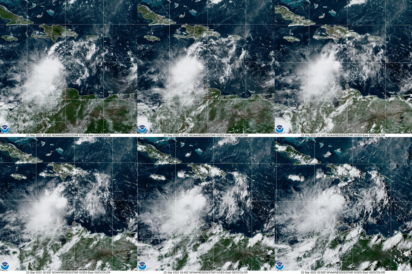
“Some slow strengthening is forecast during the next day or so, and the depression is expected to become a tropical storm by tonight. More significant intensification is forecast on Sunday and Monday,
and the system is forecast to become a hurricane by early Monday,” the NHC said in a 5:00 pm bulletin.
Models of Ian plot the system intensifying into major hurricane strength by the time it slams into the western coast of Florida around Wednesday afternoon.




Comments