
Barbados activates flash flood warning as tropical wave dumps torrential rains

Gavin Riley / Our Today
administrator
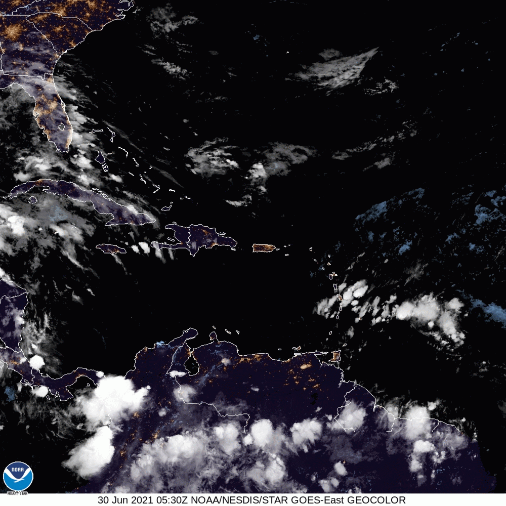
The Barbados Meteorological Service (BMS) has activated a flash flood warning for the island on Wednesday (June 30), as the first of two tropical waves drenches sections of the Eastern Caribbean.
The BMS, in a bulletin, said the flood warning will run from 5:00 am to 12:00 pm or sooner if conditions warrant.
The agency said it expected maximum rainfall levels up to 100 millimetres in “heavy to violent showers” associated with the tropical wave, Invest 95, which are already occurring on the island.
Apart from the higher-than-normal rains, the BMS is also alerting Barbadians to increased, severe lightning activity associated with widespread thunderstorms.
The weather group added that an increased likelihood of power outages is possible if lightning strikes power utility infrastructure.
As at 7:00 am Eastern Daylight Time (EDT), Invest 95 was located just east of the Windward Islands and had completely blanketed Barbados.
The US-based National Hurricane Center (NHC), which is also monitoring the disorganised system, said significant development was unlikely in the next two to five days.
The NHC warned, however, that regardless of strengthening the tropical wave could bring locally heavy rainfall to portions of the Lesser Antilles over the coming days.
The formation chances for Invest 95 are currently “low”, according to the NHC, at 10 per cent.


Comments