
Brace yourselves: Massive Saharan dust cloud settles over Jamaica

Gavin Riley / Our Today
administrator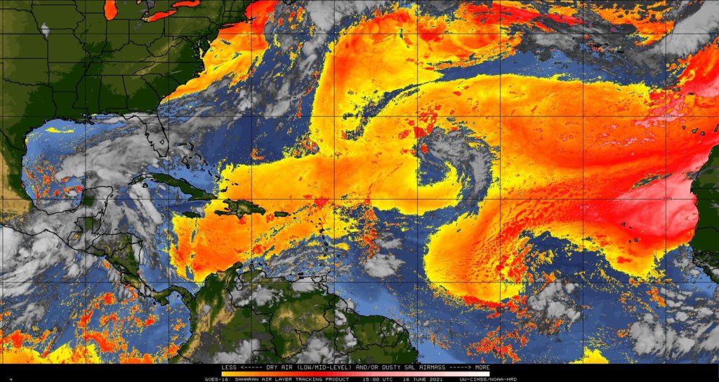
The once-blue skies over Jamaica have been reduced to a murky brown hue as a massive ‘cloud’ of Saharan dust has reached the central Caribbean on Wednesday (June 16).
For its part, the Jamaica Meteorological Service is advising citizens that the Saharan dust blanketing sections of the island today, won’t subside anytime soon thanks to a high-pressure ridge hovering over the country.
Satellite imagery of the Saharan Air Layer (SAL), tracked by the US-based National Oceanic and Atmospheric Administration (NOAA) show the dust cloud has completely covered Hispaniola, Puerto Rico, the Turks and Caicos Islands as well as southern Bahamas and northern sections of the Leeward Islands.
The Met Office, in its Wednesday forecast, further warned that hazy, windy conditions will persist well into the weekend, as the dust plume and a low-level jet stream dominate Jamaican weather.
The Met Office said it anticipates partly cloudy and hazy skies across much of the island this afternoon, with winds picking up mainly in southern parishes. It should be partly cloudy tonight.
Maximum temperatures in major cities Kingston and Montego Bay may climb as high as 33 and 34 degrees Celcius respectively.
For what to expect, see the Jamaica Met Service’s three-day outlook:
Thursday: Partly cloudy, windy and hazy.
Friday/Saturday: Isolated afternoon showers mainly across western parishes and hilly inland areas, otherwise partly cloudy. Windy especially across southern parishes.


Comments