DOUBLE TROUBLE: Unusual June activity intensifies as second tropical wave emerges, poised to develop

/ Our Today
administrator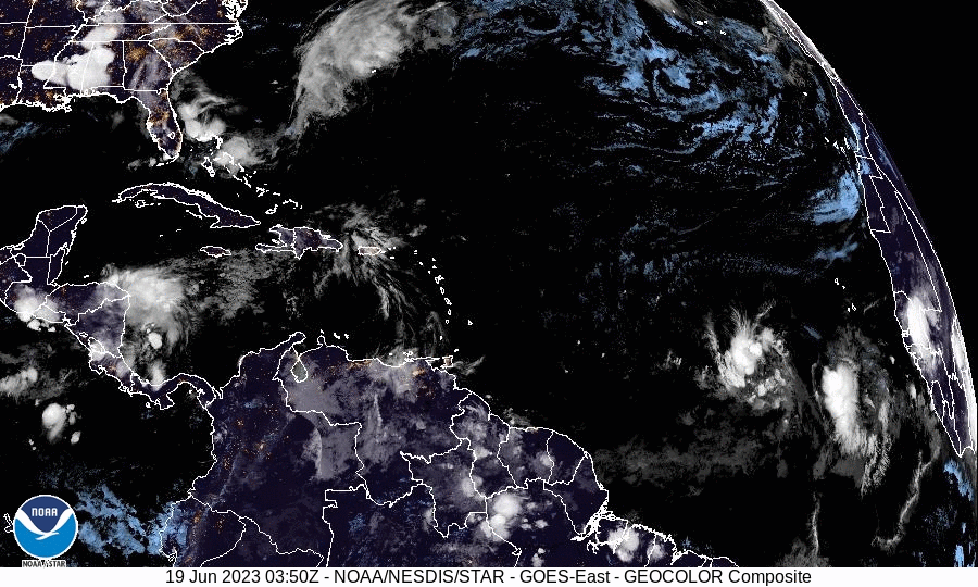
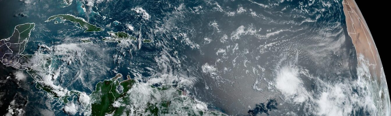
As the US-based National Hurricane Center (NHC) expects Invest92-L to develop into a tropical depression as early as today (June 19), a second tropical wave with the potential to strengthen has emerged off the coast of West Africa.
In what is shaping up to be a most unusual June, the Caribbean could be threatened by two systems in the first month of what was initially forecast to be a “near-normal season”.
I can’t get over how we have two impressive looking tropical disturbances the eastern Atlantic tonight. This is not normal for June. pic.twitter.com/0PbxY5Oslk
— Dylan Federico (@DylanFedericoWX) June 19, 2023
Invest92-L, whose centre satellite imagery located halfway between Africa and the Eastern Caribbean, has become better organised overnight and is close to becoming a tropical cyclone.
“If current trends continue, advisories could be initiated on a tropical depression later today. This system is forecast to move generally westward at 15 to 20 [miles/hour] with further development across the central tropical Atlantic through the middle part of this week,” the NHC advised.
Development chances over the next two-to-seven days are both ‘high’ at near 100 per cent certainty, with the next available name on the 2023 North Atlantic Hurricane Season being ‘Bret’.
The second tropical disturbance was last situated several hundred miles south-southwest of the Cabo Verde Islands.
According to NHC meteorologists, showers and thunderstorms associated with the tropical wave have increased and further development is possible, with a tropical depression potentially forming “within the next few days while the system moves westward at 10 to 15 mph across the eastern and central tropical Atlantic”.

At formation chances of 30 and 40 per cent over the next two-to-seven days, Cindy would be the next name from the hurricane season list, should projections pan out.
READ MORE:
- NHC on alert as tropical wave brews ahead of likely Caribbean approach
- NHC warns ‘Bret likely to form’ as development chances rise
- Caribbean again on alert as Invest92-L starts organising, tropical wave trajectory shifts


Comments