
Met Service extends flash flood watch for eastern Jamaica

Gavin Riley / Our Today
administrator
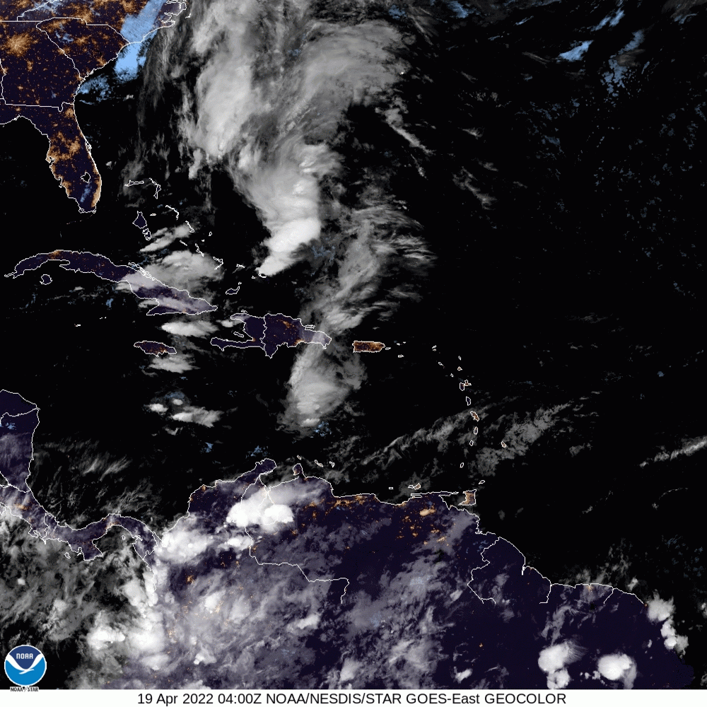
The Jamaica Meteorological Service has extended its flash flood watch for eastern sections of the island, owing to the effects of a lingering trough in the central Caribbean.
In a Tuesday (April 19) bulletin, the Met Service advised that the flash flood watch for St Thomas, Portland and St Mary will now be lifted at 8:00 am tomorrow.
Already, the Hordley main road between Portland and St Thomas is blocked due to heavy rain, the Jamaica Constabulary Force (JCF) disclosed. In its alert to the motoring public, the JCF advised that the only alternative route is through the parish of St Mary.
Though specific to eastern Jamaica, remaining areas outside the flash flood watch zone are also due for afternoon showers today, which the local weather watchdog noted could continue well into this week.
“Observational data indicate that light to moderate showers and isolated thunderstorms occurred mainly across eastern parishes throughout the night,” the Met Service explained.
“The forecast is for light to moderate morning showers across sections of eastern parishes, with moderate to heavy afternoon and evening showers and thunderstorms across sections of most parishes. Nighttime showers and thunderstorms are also expected across eastern parishes. This pattern is projected
to continue throughout this week,” the agency added.
In the meantime, the maximum temperature expected in major cities Kingston and Montego Bay is 31 degrees Celcius respectively.
See more in the Jamaica Met Office’s town/city forecast:
| Towns and Cities | Forecast |
| Morant Bay | Intermittent showers |
| Kingston | Mostly cloudy morning/Late afternoon thundershowers |
| Half-Way-Tree | Mostly cloudy morning/Late afternoon thundershowers |
| Portmore | Partly cloudy morning/Late afternoon thundershowers |
| Spanish Town | Partly cloudy morning/Late afternoon thundershowers |
| May Pen | Partly cloudy morning/Late afternoon thundershowers |
| Mandeville | Partly cloudy morning/Afternoon thundershowers |
| Santa Cruz | Mainly sunny morning/Afternoon showers |
| Black River | Mostly cloudy afternoon |
| Savanna-La-Mar | Mostly cloudy afternoon |
| Negril | Mostly cloudy afternoon |
| Port Antonio | Mostly cloudy morning/Late afternoon thundershowers |
| Port Maria | Partly cloudy morning/Late afternoon thundershowers |
| Ocho Rios | Partly cloudy morning/Late afternoon thundershowers |
| St Ann’s Bay | Partly cloudy morning/Late afternoon thundershowers |
| Browns Town | Partly cloudy morning/Late afternoon thundershowers |
| Falmouth | Mostly cloudy afternoon |
| Montego Bay | Mostly cloudy afternoon |
| Lucea | Mostly cloudy afternoon |
The Met Service has also advised fisherfolk and other marine interests that its small craft warning remains in effect. The warning covers inshore and offshore areas of Jamaica’s north and south coast due to strong winds and rough seas in the vicinity of thundershowers.
For more, see three-day forecast:
Wednesday: Morning showers and isolated thunderstorms across eastern parishes, otherwise partly cloudy. Scattered afternoon showers and thunderstorms across most parishes. Nighttime showers and isolated thunderstorms across eastern parishes.
Thursday / Friday: Morning showers across sections of northeastern parishes, otherwise partly cloudy. Scattered afternoon showers across most parishes, with thunderstorms across sections of southern parishes. Nighttime showers across northeastern parishes.


Comments