Gathering steam: Trough in western Caribbean likely to strengthen, analysts warn

/ Our Today
administrator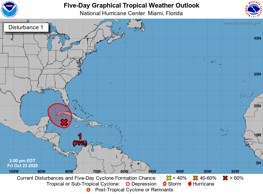
Meteorologists watching a low-pressure trough in the western Caribbean Sea are expecting the system to develop into a tropical depression within the next two days, amid further signals of intensification on Friday (October 23).
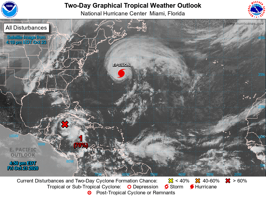
According to the US-based National Hurricane Center (NHC), the trough, located just southwest of the Cayman Islands now has a 70 per cent likelihood to become the 27th tropical depression of the 2020 north Atlantic season.
“Satellite images and radar data indicate that the broad area of low pressure located just west of Grand Cayman Island is gradually becoming better defined,” the NHC advised in a 3:00 pm Eastern Standard Time (EST) update.
“Environmental conditions appear conducive for further development, and a tropical depression will likely form during the next day or two while the low drifts toward the northwest,” the statement continued.
In the meantime, the NHC indicated that the system could move near western Cuba by Sunday before slowly approaching the southeastern Gulf of Mexico early next week.
The hurricane watchdog warned that regardless of development, locally heavy rainfall will be possible over portions of the Cayman Islands, Jamaica, Cuba, southern Florida, Florida Keys, and northwestern Bahamas through the weekend.
Already, the trough has claimed the life of one man in Jamaica, Romero Leechman, who died on Friday after a landslide swept his Shooter’s Hill, St Andrew home. His 15-year-old daughter is still missing.

The Jamaica Met Service has activated a flash flood watch for low-lying areas islandwide, which will remain in effect until Saturday. In its three-day forecast, the agency noted that weather conditions be will mostly cloudy through to Monday, with periods of showers and thunderstorms across most parishes during the day.
Jamaicans have also been urged to expect more night-time showers across southern parishes and strong gusts of wind, especially along the island’s south.
Additionally, the Cayman Islands National Weather Service has activated a flash flood warning across all divisions in the territory for the next 24 hours.


Comments