Hurricane Larry weakens further, still no threat to land

Gavin Riley / Our Today
administratorBermuda activates tropical storm warning, two potential systems also being watched

Larry continues to weaken in the open Atlantic on Wednesday (September 8), and, while it remains no threat to land, meteorologists at the US-based National Hurricane Center (NHC) are monitoring two other disturbances.
Anticipating some impact from Hurricane Larry, the Bermuda Weather Service issued a tropical storm warning for the island as projections place the centre of the storm passing just east of the territory.
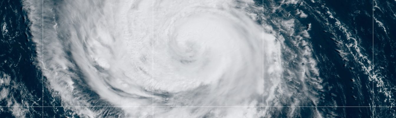
In an 8:00 am Atlantic Standard Time (AST) advisory, the NHC indicated that the centre of Hurricane Larry was located near 27.0 North, longitude 57.7 West—or roughly 905 kilometres southeast of Bermuda.
The massive storm is moving northwest at 17 kilometres/hour, packing maximum sustained winds of 185 kilometres/hour, with higher gusts.
Larry is incrementally weaker than its 201 kilometres/hour peak on Monday, however, the hurricane endures as a powerful category three system.
The NHC, in its forecast, said it anticipated a “gradual weakening of Larry” over the next several days. However, the third major hurricane of the 2021 North Atlantic season is most likely “to remain a hurricane during that time”.

Hurricane-force winds extend outward up to 110 kilometres from Larry’s centre, while tropical-storm-force winds extend outward up to 295 kilometres.
The greatest threat posed to land is hurricane-generated swells, which the watchdog agency noted: “Will continue to affect the Leeward Islands, portions of the Greater Antilles, and the Bahamas through midweek, and impact Bermuda through the end of the week.”
In the meantime, two other disturbances present varying levels of concern, with the next two available names on the 2021 Hurricane Season list being ‘Mindy’ and ‘Nicholas’.
The first system is a surface trough and an upper-level disturbance over the central and eastern Gulf of Mexico, which is producing some “disorganised cloudiness and a few thunderstorms”.
According to NHC sleuths, the system is expected to move northeast over the Gulf of Mexico later today, where upper-level winds could become slightly more favourable to support tropical or subtropical development as the trough nears the northern Gulf coast tonight or early Thursday.
“The disturbance is then expected to cross the southeastern United States, and some additional development will be possible after it emerges off the southeastern United States coast late this week. Regardless of
development, areas of heavy rainfall will be possible across portions of the Florida panhandle and southern Georgia through Thursday, with localised flooding possible,” the NHC detailed.
Its formation chances over the next two to five days are set at a ‘medium’ 50 per cent respectively.
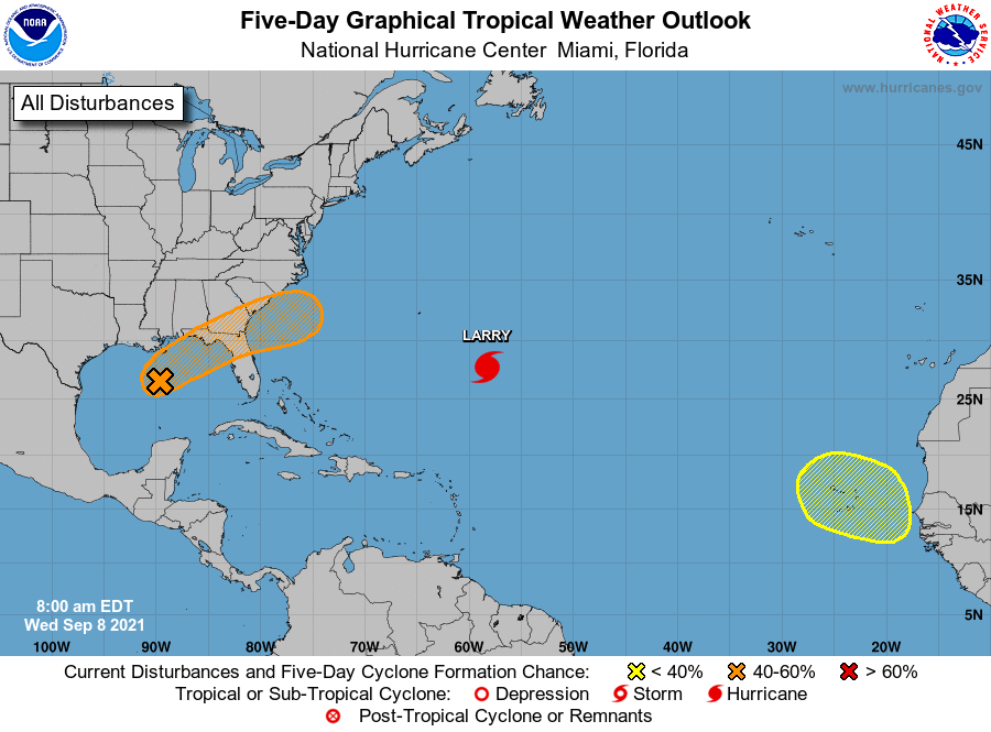
The second disturbance is a tropical wave, which the NHC expects will emerge off the West African coast in a few days.
“Some development of this system is possible thereafter as it moves west-northwestward over the far eastern Atlantic,” the Miami-headquartered agency said, adding that formation chances over the next five days are ‘low’, at 20 per cent.
- See previous article: Hurricane Larry ‘winning’ battle against Saharan dust, system now expected to weaken


Comments