Hurricane Milton strengthens to Category 5

Vanassa McKenzie / Our Today
editor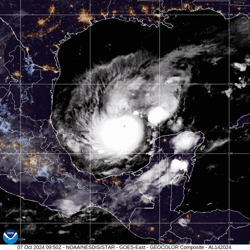
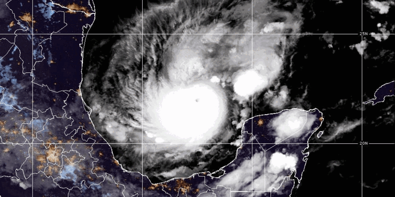
Hurricane Milton has strengthened to a Category 5 hurricane as it continues to rapidly intensify in the Gulf of Mexico.
The powerful weather system has maximum sustained winds of 160 mph as it continues across the Gulf of Mexico. The eye of Hurricane Milton was located near latitude 21.7 North and longitude 91.7 west as of 10:00 am central time.
The hurricane quickly strengthened from Category 2 to Category 5.
According to the US-based National Hurricane Center, Milton is expected to approach the west coast of Florida by Wednesday. It said significant impacts are likely with a large and powerful hurricane at landfall in Florida, with life-threatening hazards along portions of the coastline.
“By tomorrow, its intensity should be dictated by an eyewall replacement cycles, which will likely cause the system to gradually weaken but grow larger. After 36 hours, Milton is expected to encounter a
much less favourable environment with strong shear and dry air entrainment,” said the National Hurricane Centre.
“Therefore, some weakening is anticipated before the hurricane reaches the Florida Gulf coast. However, the system is still likely to be a large and powerful hurricane at landfall in Florida, with life-threatening hazards at the coastline and well inland. After landfall, Milton should weaken and start extratropical transition, which should be complete by 96 hours,” it added.
A hurricane watch has been issued for sections of Florida.
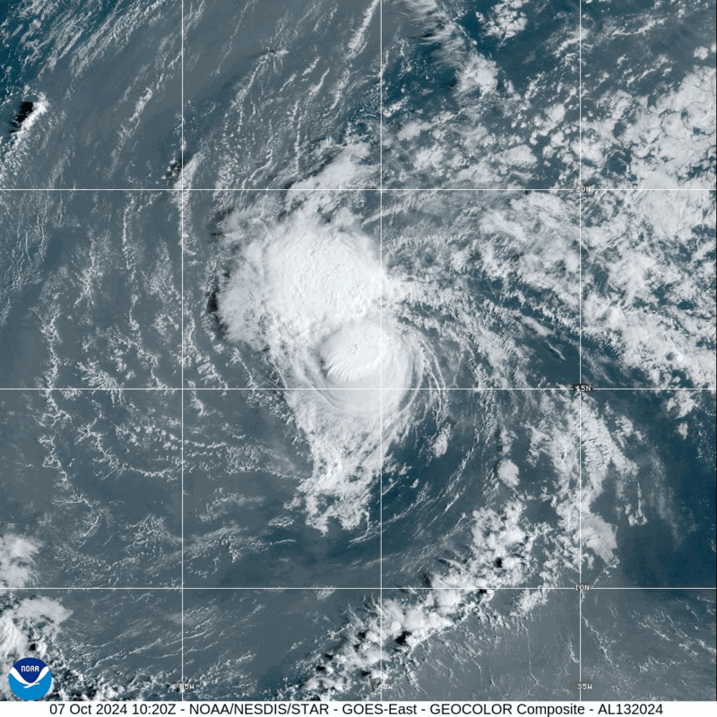
Meanwhile, Hurricane Leslie is slightly weaker as it continues to move across the Atlantic Ocean northwestward. The center of Leslie was located near 16.4, -41.2 with movement NW at 13 mph. The minimum central pressure was 985 mb with maximum sustained winds of about 85 mph.
At the same time, Kirk has completed its transition to an extratropical cyclone and is expected to remain a large and powerful extratropical cyclone over the next couple of days as it moves east-northeastward across the northeastern Atlantic Ocean toward western Europe.
“Swells from Kirk may continue to induce a high rip current risk along portions of the US East Coast for another day or so. These swells will affect Bermuda, Atlantic Canada and the Azores for a few more days. Kirk will move over western Europe by late Wednesday,” the Miami-based weather service said.


Comments