
Jamaica starts May with heavy cloud cover, rains as Eastern Caribbean trough lingers

Gavin Riley / Our Today
administrator
The Jamaica Meteorological Service says an approaching trough from the Eastern Caribbean spells unstable weather for the island starting Sunday afternoon (May 1).
The Met Service, in a news release on Friday, is forecasting increased rainfall for eastern and central parishes as the trough weakens, after which weather sleuths anticipate conditions will gradually improve into early next week.
“The forecast is for periods of moderate to heavy showers and thunderstorms to affect sections of mainly eastern and central parishes (St Ann, St Mary, Portland, St Thomas, Kingston and St Andrew, St Catherine, Clarendon, Manchester and St Elizabeth) starting Sunday and continuing into Monday. Additionally, occasional gusty winds are likely to occur in the vicinity of thunderstorms,” the agency advised.
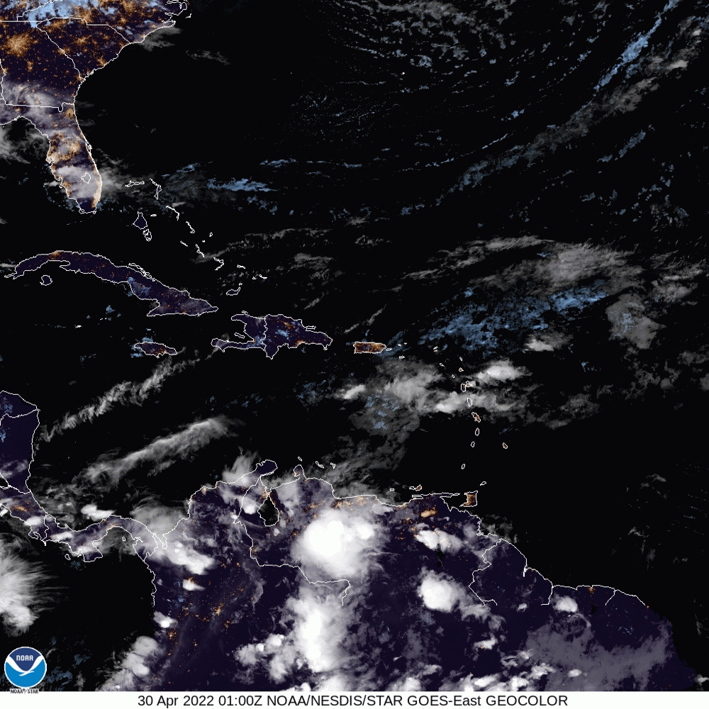
In addition to the trough straddling the Eastern Caribbean, satellite imagery also notes the presence of an area of low pressure in the vicinity of Panama.
The maximum temperature expected in major cities Kingston and Montego Bay is 31 degrees Celcius respectively.
See more in the Jamaica Met Office’s town/city forecast:
| Towns and Cities | Forecast |
| Morant Bay | Partly cloudy afternoon |
| Kingston | Partly cloudy afternoon |
| Half-Way-Tree | Partly cloudy afternoon |
| Portmore | Partly cloudy afternoon |
| Spanish Town | Afternoon showers |
| May Pen | Partly cloudy afternoon |
| Mandeville | Afternoon showers |
| Santa Cruz | Afternoon thunderstorms |
| Black River | Afternoon showers |
| Savanna-La-Mar | Afternoon thunderstorms |
| Negril | Afternoon showers |
| Port Antonio | Partly cloudy |
| Port Maria | Partly cloudy |
| Ocho Rios | Partly cloudy |
| St Ann’s Bay | Partly cloudy |
| Browns Town | Mostly cloudy afternoon |
| Falmouth | Partly cloudy/Afternoon showers |
| Montego Bay | Partly cloudy/Afternoon showers |
| Lucea | Partly cloudy/Afternoon showers |
There are no small craft warnings activated for either inshore and offshore areas of Jamaica’s north and south coasts, however, the Met Service is encouraging fisherfolk and other marine interests to exercise caution as sea conditions could quickly deteriorate in the vicinity of thunderstorms.
For more, see three-day outlook:
Sunday: Morning showers and isolated thunderstorms across south-central and eastern parishes. Becoming mostly cloudy with periods of showers and thunderstorms especially across eastern and central parishes during the afternoon to late evening.
Monday: Mostly cloudy with showers and isolated thunderstorms especially across eastern and central parishes. Windy along the south coast.
Tuesday: Isolated morning showers across sections of northern and southeastern parishes. Scattered afternoon showers and thunderstorms across central and western parishes.


Comments