‘Major Hurricane Eta’: Category 3 storm set to devastate Central America

Gavin Riley / Our Today
administrator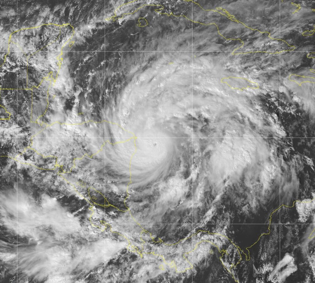
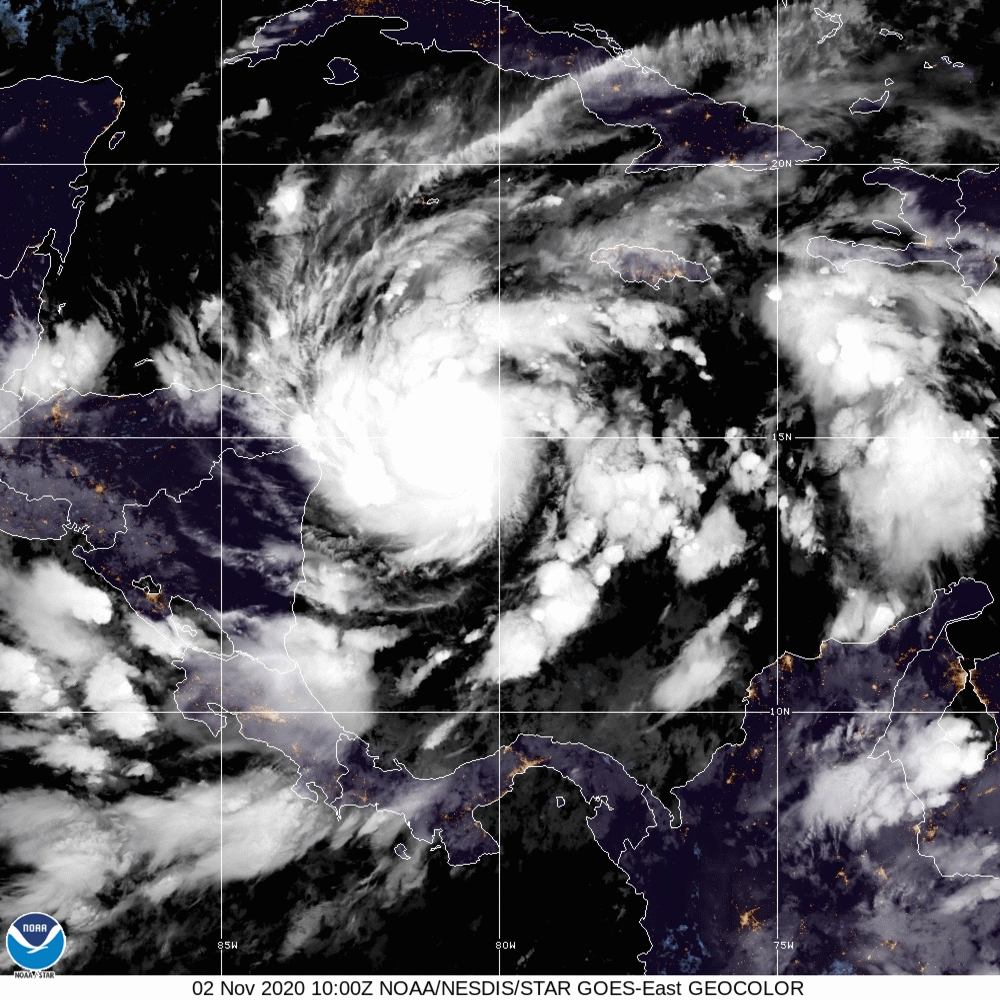
Hurricane Eta has strengthened to a nightmarish category three storm on Monday (November 2), and, hours away from slamming sections of Nicaragua and Honduras, conditions in the central Caribbean could propel the system to become stronger still.
Meteorologists at the US-based National Hurricane Center (NHC), watching Eta swell into the 12th hurricane this season, project the massive cyclone to devastate Central America when it makes landfall on Tuesday.
In a 1:00 pm Eastern Standard Time (EST) advisory, the NHC indicted that Hurricane Eta is packing maximum sustained winds of 195 kilometres/hour, with higher gusts.
“Satellite data indicate that Eta continues to rapidly strengthen. Eta is a category 3 hurricane on the Saffir-Simpson Hurricane Wind Scale. Continued strengthening is expected until Eta reaches the coast of Nicaragua. Weakening will begin after the system moves inland,” the NHC contended.
Hurricane Eta is currently located at latitude 14.7 North, longitude 82.0 West—or roughly 135 kilometres east of Cabo Gracias a Dios on the Nicaragua/Honduras border.
The storm has again slowed but continues to move west at 15 kilometres/hour.
Hurricane-force winds extend outward up to 35 kilometres) from Eta’s centre, while tropical-storm-force winds extend outward up to 185 kilometres.
The latest minimum central pressure reported by National Oceanic and Atmospheric Administration (NOAA) reconnaissance aircraft is 957 millibars (28.26 inches).
Eta joins four other hurricanes, Laura, Teddy, Delta and Epsilon—that became major (category 3 or stronger) storms this year.
Aside from the damaging winds, water in epic proportions will the next biggest concern with Eta.
According to NHC forecasts, storm surges could be as high as 12-18 feet above normal tide levels along the Nicaragua coast, and rainfall could be up to 35 inches for portions of Central America. Both hazards are likely to cause life-threatening and catastrophic damage.

“Catastrophic wind damage is expected where Eta’s eyewall moves onshore within the hurricane warning area beginning tonight, with tropical storm conditions expected by this afternoon. Tropical storm conditions are expected in the tropical storm warning area by this afternoon, and hurricane conditions are possible in the hurricane watch area by early Tuesday. Tropical storm conditions are possible in the tropical storm watch area by early Tuesday,”
Rainfall the NHC added, will persist until Friday—leading to catastrophic, life-threatening flash flooding and river flooding, along with landslides in areas of higher terrain of Central America.
“Flash flooding and river flooding would be possible across Jamaica, southeast Mexico, El Salvador, southern Haiti, and the Cayman Islands,” the weather watchdog argued.
See related stories on Hurricane Eta below:
- TS Eta to swell into category two hurricane before direct Central American hit
- Tropical Storm Eta forms, expected to become hurricane


Comments