
Met Service forecasts showers for Jamaica ahead of weak tropical wave

Gavin Riley / Our Today
administrator
The Jamaica Meteorological Service says cloudy conditions will dominate local skies as a trough hovering over the island is expected to give way to a weak tropical wave come Wednesday (July 6).
The Met Service, in its 5:00 am bulletin, is forecasting the trough to continue lingering above Jamaica.
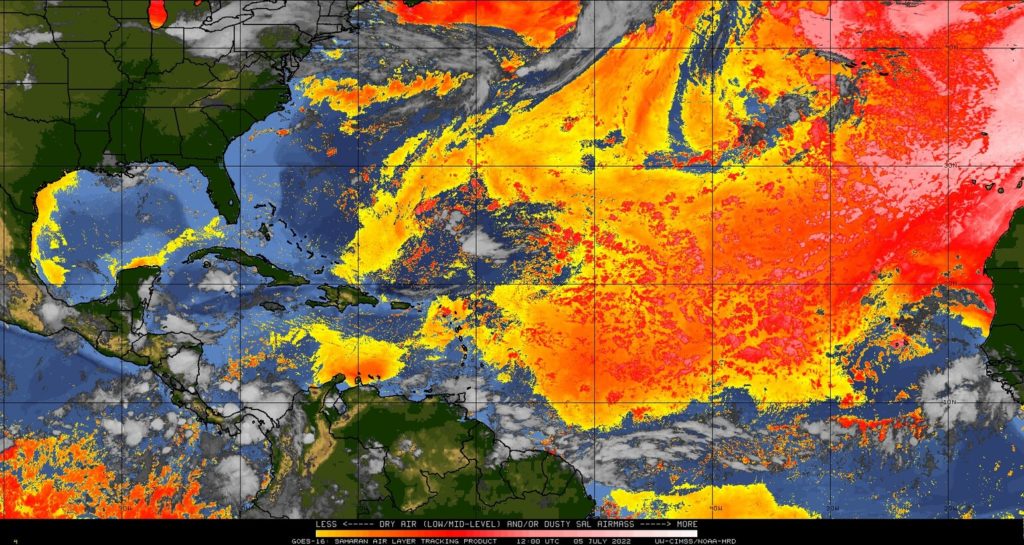
After a busy week with tropical storms Bonnie and Colin forming, the Caribbean Basin is largely quiet again though disturbances persist on its northeast, northwest, southeast and southwest fringes.
Additionally, satellite imagery tracking the Saharan Air Layer (SAL) attests to the presence of a thin layer of dust approaching the northeastern Caribbean.
In the meantime, the maximum temperature anticipated in major Jamaican cities, Kingston and Montego Bay respectively, is a balmy 34 degrees Celcius.
Breakdown of towns and cities forecast:
| Towns and Cities | Forecast |
| Morant Bay | Partly cloudy/Windy |
| Kingston | Partly cloudy/Windy |
| Half-Way-Tree | Partly cloudy |
| Portmore | Partly cloudy/Windy |
| Spanish Town | Mostly cloudy afternoon |
| May Pen | Afternoon thundershowers |
| Mandeville | Afternoon thundershowers |
| Santa Cruz | Afternoon thundershowers |
| Black River | Mostly cloudy afternoon |
| Savanna-La-Mar | Afternoon thundershowers |
| Negril | Afternoon showers |
| Port Antonio | Partly cloudy |
| Port Maria | Partly cloudy |
| Ocho Rios | Partly cloudy |
| St Ann’s Bay | Partly cloudy |
| Browns Town | Afternoon showers |
| Falmouth | Mostly cloudy afternoon |
| Montego Bay | Afternoon thunderstorms |
| Lucea | Afternoon thundershowers |
The Jamaica Met Service has also activated a small craft warning for inshore and offshore areas of the south coast. Fisherfolk and marine interests should exercise caution due to strong winds and rough seas.
See Met Service’s three-day outlook:
Wednesday: Partly cloudy morning. Afternoon showers and thunderstorms in sections of southern and northwestern parishes.
Thursday: Morning showers across eastern parishes, otherwise partly cloudy. Afternoon and evening showers and thunderstorms across most parishes. Windy along the south coast.
Friday: Isolated afternoon showers and thunderstorms across western parishes, otherwise partly cloudy. Windy.


Comments