Police impose curfews in Kingston and St Mary communities

/ Our Today
administrator
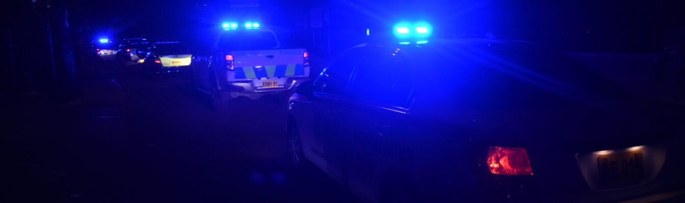
The Jamaica Constabulary Force (JCF) has imposed curfew restrictions on four communities across Kingston and St Mary, each effective until 6:00 pm Thursday (January 9).
The curfews, launched at 6:00 pm Tuesday, cover sections of Albion Mountain, Payne Land, Whitfield Town and Olympic Gardens.
During the hours of the curfew, residents within its boundaries are required to remain within their premises, unless otherwise authorised by the ground commander.
The curfew boundaries are as follows:
- Samocan Drive, Olympic Gardens
North: Along West Bay Farm Road with an imaginary line behind Balcombe Drive Primary and Junior High School to Seaward Drive, approximately 650 meters.
South: Along Olympic Way from the intersection with Seaward Drive to an imaginary line in the vicinity of Balcombe Drive Seventh Day Adventist Church, approximately 490 meters.
East: Along Seaward Drive from the intersection of Seaward Drive and Olympic Way to an imaginary line behind Balcombe Drive Primary and Junior High School, approximately 186 meters.
West: Imaginary line in the vicinity of Balcombe Drive Seventh Day Adventist Church to a section of West Bay Farm Road, approximately 258 meters.
- Whitfield Town
North: Along Berwick Road from the intersection of Berwick Road and Waltham Park Road to the intersection of Maxfield Avenue and Berwick Road, approximately 680 meters.
West: Along Waltham Park Road from the intersection of Spanish Town Road and Waltham Park Road to the intersection of Berwick Road and Waltham Park Road, approximately 830 meters.
East: Along Maxfield Avenue from the intersection of Maxfield Avenue and Berwick Road to the intersection of Spanish Town Road and Maxfield Avenue, approximately 1,264 meters.
South: Along a section of Spanish Town Road from the intersection of Spanish Town Road and Maxfield Avenue to the intersection of Waltham Park Road and Spanish Town Road, approximately 300 meters.
- Payne Land
North: Along South Anderson Crescent from a section of Delacree Lane to the intersection of South Anderson Crescent and McKoy Lane, approximately 457 meters.
East: Along McKoy Lane from the intersection of McKoy Lane and South Anderson Crescent to the intersection of Spanish Town Road and McKoy Lane, approximately 465 meters.
South: Along Spanish Town Road from the intersection of Spanish Town Road and McKoy Lane to the intersection of Delacree Lane and Spanish Town Road, approximately 103 meters.
West: Along Delacree Lane from the intersection of Spanish Town Road and Delacree Lane to a section at the top of Delacree Lane, approximately 505 meters.
- Albion Mountain
North: Along a section of Top Mountain in the vicinity of the Albion Mountain Square. An imaginary line runs approximately 1,675 meters east to a section of the Trinity Land Main Road.
East: Along a section of the Trinity Land Main Road. An imaginary line runs approximately 1,517 meters south to a Y-junction intersection along a section of the Cox Street Main Road.
South: Along Cox Street Main Road at the Y-junction intersection, veering left to Roslyn Road and right to Trinity Land Main Road. An imaginary line runs approximately 1,897 meters west to a section of Roslyn Road.
West: Along a section of Roslyn Road. An imaginary line runs approximately 1,451 meters north to a section of Top Mountain in the vicinity of Albion Mountain Square.


Comments