Rapidly intensifying Hurricane Erick threatens Mexico’s Pacific Coast

/ Our Today
administrator
MEXICO CITY (Reuters)
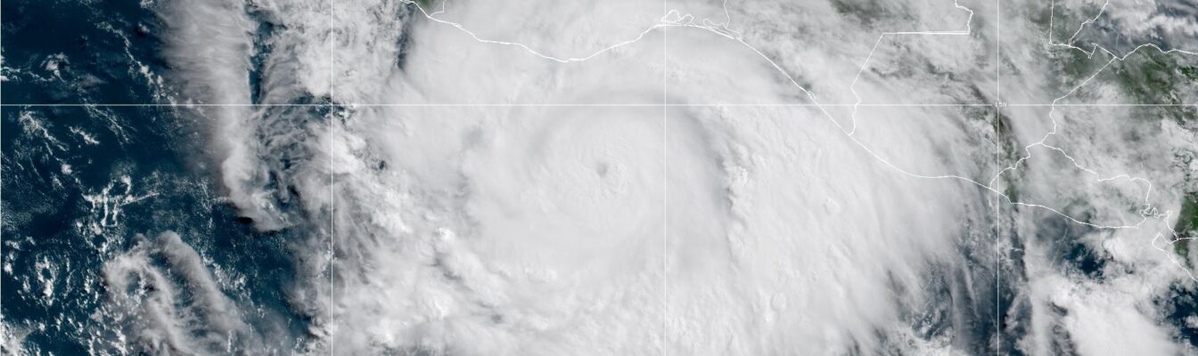
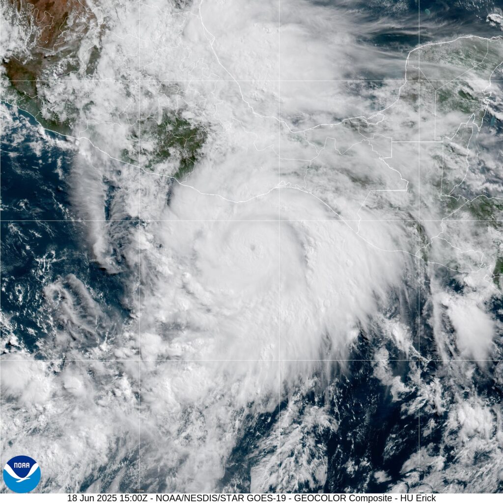
Hurricane Erick is rapidly intensifying off the Pacific Coast of Mexico on Wednesday (June 18), as the U.S. National Hurricane Center (NHC) projects the system to reach major hurricane strength (category three or higher) before its landfall later tonight.
Erick, already the fifth named system of the Eastern Pacific Season, is expected to be the first hurricane to make landfall in Mexico this season, and would bring “life-threatening flash floods to portions of southern Mexico later tonight and Thursday,” the NHC said in a report.
Maximum sustained winds have increased to 140 kilometres/hour in the NHC’s 9:00 am Central Standard Time (CST) advisory, with Erick moving northwest at nearly 13 kilometres/hour.
“Erick is rapidly intensifying, and maximum sustained winds have increased to near 85 mph (140 km/h) with higher gusts. Rapid strengthening is expected to continue today, and Erick is forecast to reach major hurricane strength tonight or early Thursday as it approaches the coast of southern Mexico,” the center warned.
“Erick could develop into a Category 2 hurricane in the first minutes of Thursday, and it could make landfall between Oaxaca and Guerrero during the day,” the head of Mexico’s civil protection agency, Laura Velazquez, told a presidential press conference.
Both states have begun emergency planning, taken preventive actions with local authorities, and activated over 500 temporary shelters, she added.
Mexican authorities will also provide care and evacuation for tourists in the area, which has popular beaches and resort towns such as Acapulco.
During her morning press conference, Mexican President Claudia Sheinbaum urged residents to stay indoors and move to shelters if they are in flood-prone areas.
Mexico’s national water commission, Conagua, said in a statement that rainfall in Oaxaca and Guerrero could lead to landslides and flooding.


Comments