Supplementary list now at play as 2021 Hurricane Season exhausts all 21 ‘original’ storm names

Gavin Riley / Our Today
administrator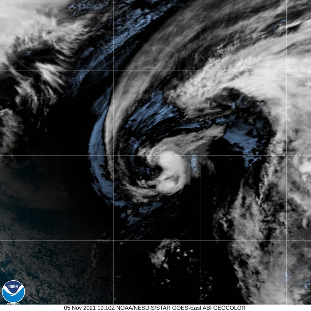
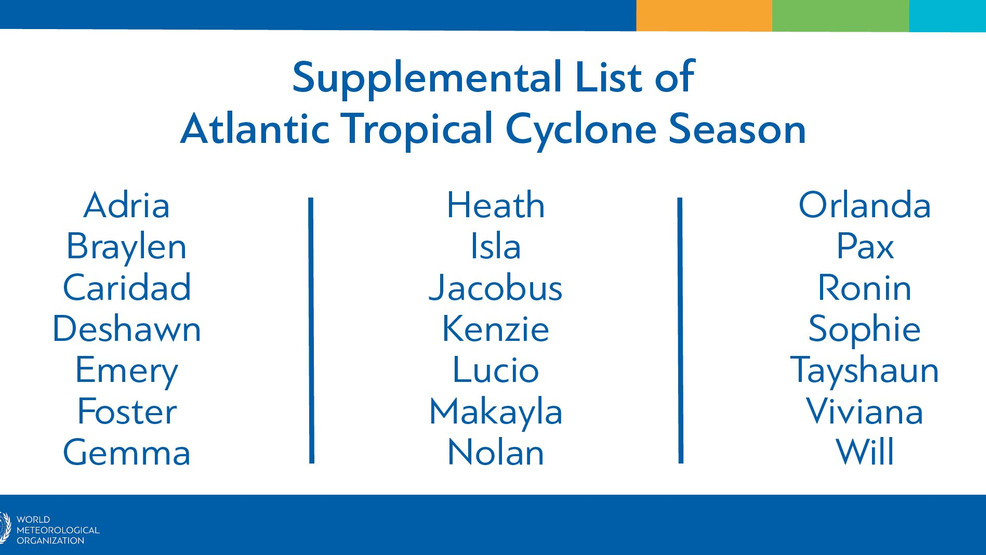
With just three weeks to go before the official end of the 2021 North Atlantic Hurricane Season, the World Meteorological Organization (WMO) says it will be moving to utilise its supplementary list of storm names as the original 21 have all been used.
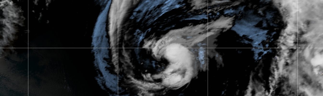
The WMO, in a statement on Friday (November 5), indicated that while it continues to track Tropical Storm Wanda in the north Atlantic Ocean, the above-average season stays true to predictions as the system stands as the last-named storm on the regular 2021 list.
If another named system forms, it will be called Adria.
“The Atlantic hurricane season 2021 has been so active that it has exhausted the regular list of storm names for the second consecutive year. WMO will now use a new list of supplemental names for any forthcoming tropical cyclones in the basin,” the United Nations weather organisation explained.
According to the WMO, the 2021 Atlantic hurricane season has so far been less devastating than last year but it has proved to be unusually active in terms of Accumulated Cyclone Energy (ACE) and the number of storms.
“Two Atlantic seasons on record have had more than 21 named storms: 2005 (28 named storms) and 2020 (30 named storms),” the WMO noted.
The season continues to evolve in surprising ways, with no major (Category 3 and above) tropical cyclones forming during October. It is a first for the Atlantic Basin, since 1977.
Hurricane Ida stands out as the season’s deadliest and most damaging storm.
At its peak, Ida reached category four intensity after barrelling through the Caribbean, leaving a trail of destruction in Cuba, Jamaica, Haiti and the Cayman Islands.
It made landfall near the city of New Orleans on August 30, on the 16th anniversary of Hurricane Katrina, causing widespread infrastructure damage and power outages in the state of Louisiana. The global oil industry was battered by Ida’s impact, which in turn sent oil prices soaring.
Other notable systems from the ongoing 2021 season are hurricanes Elsa, Grace, Larry and Sam—the latter two largely staying on the open ocean, posing no direct threat to the Caribbean.
On the forecast track, sleuths at the US-based National Hurricane Centre (NHC) TS Wanda seems to be making a bee-line for Ireland and parts of the United Kingdom early next week as an extratropical storm.
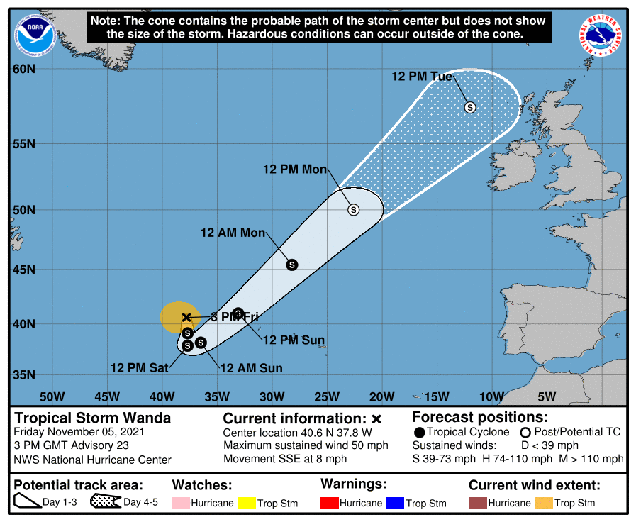
At 3:00 pm Greenwich Meridian Time (GMT), the centre of Tropical Storm Wanda was located near latitude 40.6 North, longitude 37.8 West—or roughly 970 kilometres west-southwest of The Azores.
Wanda is moving toward the south-southeast near 13 kilometres/hour, packing maximum sustained winds are near 85 kilometres/hour, with higher gusts.


Comments