Tropical Storm Rafael begins to move away from Jamaica; tropical storm warning remains in effect

/ Our Today
administrator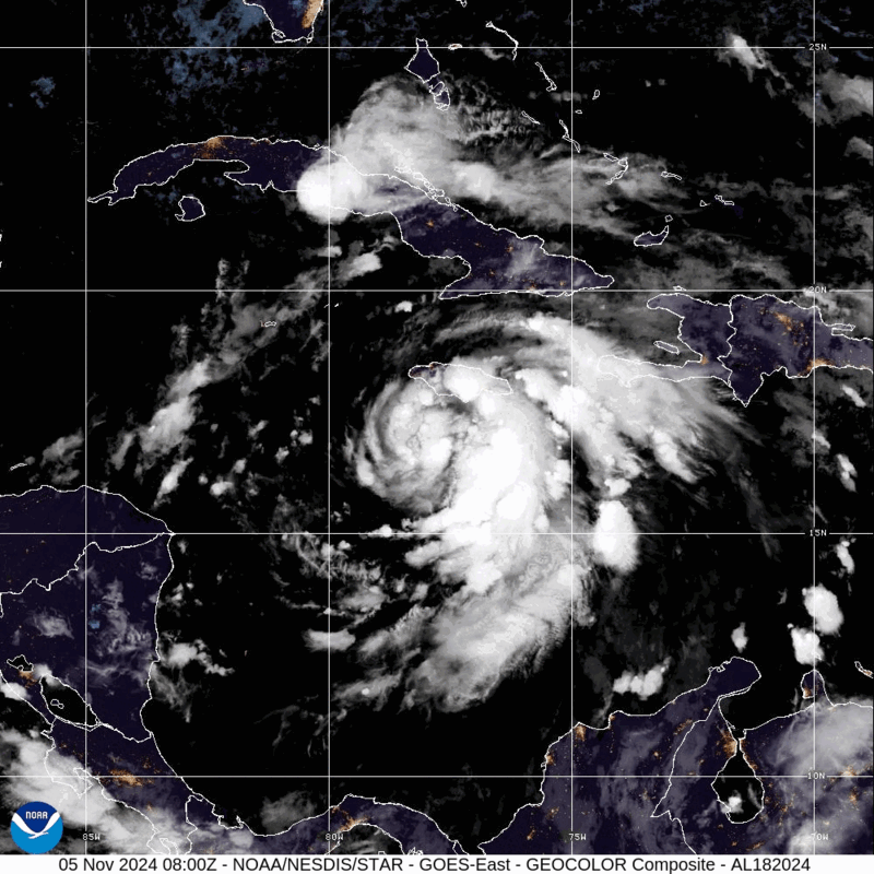
The centre of Tropical Storm Rafael has begun to move away from the western coast of Jamaica while the system gets better organized.
However, a tropical storm warning remains in effect for the island. This means that tropical storm conditions, including strong winds, heavy rainfall, and minor coastal flooding, are expected today.
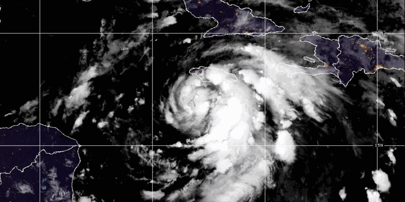
According to the Meteorological Service of Jamaica 8:00 am bulletin, at 7:00 am, the centre of Tropical Storm Rafael was located near latitude 17.4 degrees North and longitude 78.4 degrees West. This is about 130 kilometres (80 miles) southwest of Montego Bay and 180 kilometers (110 miles) south of Negril Point, Jamaica.
Rafael continues to move toward the northwest near 20 km/h (13 mph), and generally northwestward motion is anticipated over the next few days. On the forecast track, the storm is expected to begin moving away from Jamaica this morning, be near the Cayman Islands tonight, and be near or over Western Cuba on Wednesday.
Rafael’s maximum sustained winds remain near 95 km/h (60 mph) with higher gusts. Steady to rapid intensification is forecast over the next 24 to 36 hours, making Rafael a hurricane near the Cayman Islands, with further strengthening before it makes landfall in Cuba. Tropical-storm-force winds extend outward up to 165 kilometres (105 miles) from the centre.
Rainfall amounts of over 75 millimetres (3 inches) are being reported across Jamaica, primarily in sections of southern parishes, resulting in a few flooding events. These are expected to increase this morning based on the current forecast track.
Individuals can expect periods of heavy rainfall, measuring 75–10 mm, to continue to spread across Jamaica, producing flash flooding in flood prone areas island wide.
Small craft operators are reminded to remain in safe harbour until all warning messages have been lifted and wind and sea conditions have returned to normal.
The Meteorological Service says it will continue to monitor the progress of Tropical Storm Rafael, and all interests are encouraged to pay special attention to further updates.


Comments