
With five disturbances being closely monitored across the basin today (September 21), any signs of the 2022 North Atlantic Hurricane Season’s previous lull in activity have been soundly put to rest.
Meteorologists at the US-based National Hurricane Center (NHC) have their hands full this week as Hurricane Fiona, Tropical Storm Gaston and three other tropical waves pose varying degrees of threat to the Caribbean, Canada and West Africa.
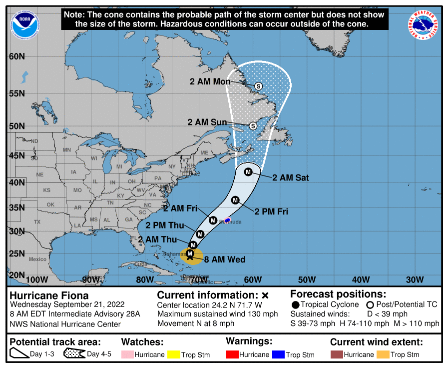
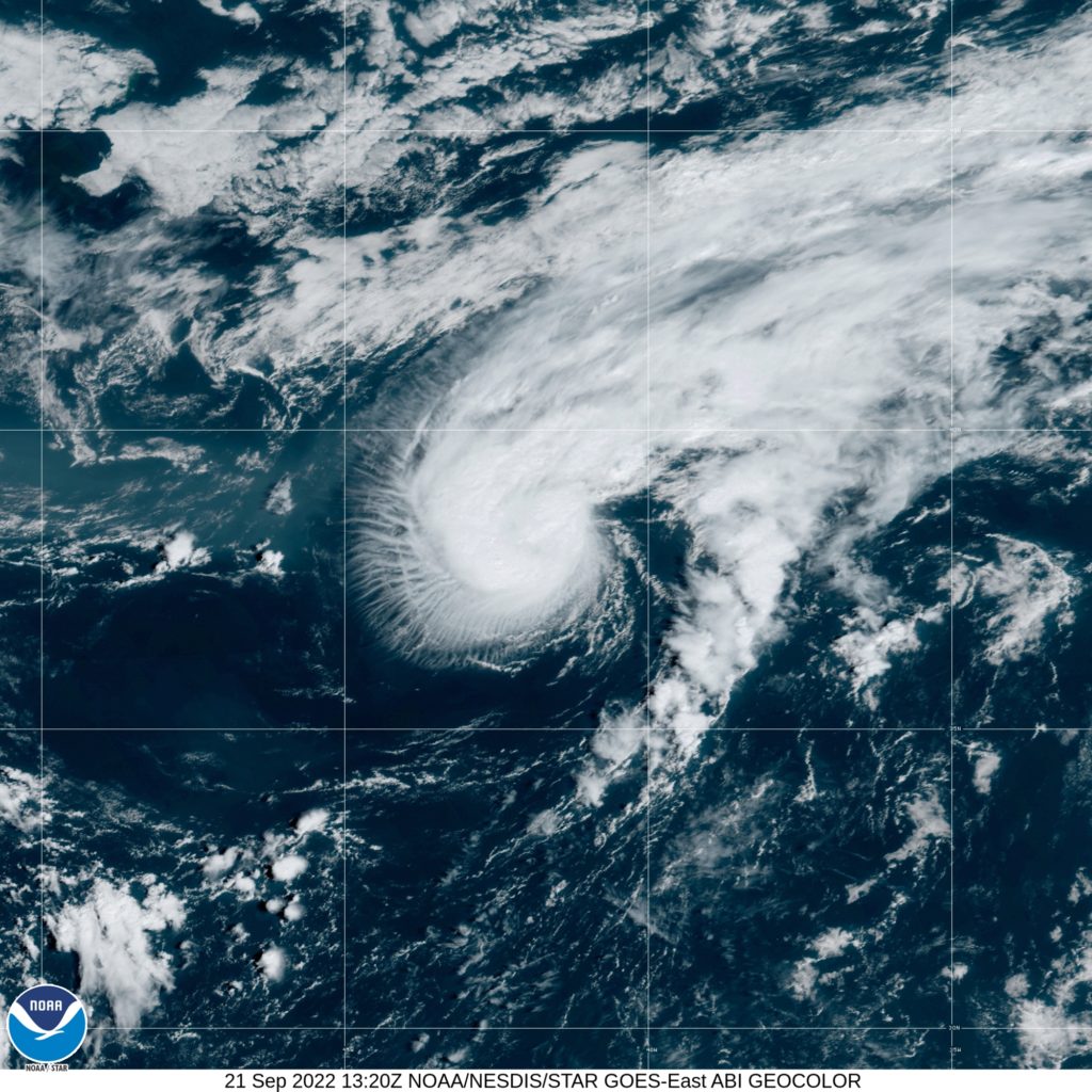
Closest to home, Hurricane Fiona continues a slow, northward crawl at 13 kilometres/hour after devastating sections of the Turks and Caicos Islands, Puerto Rico, Hispaniola and Guadeloupe.

As at 8:00 am Eastern Daylight Time (EDT), the centre of Fiona was located near latitude 24.2 North and longitude 71.7 West—or roughly 1,125 kilometres southwest of Bermuda.
The powerful category four hurricane is packing maximum sustained winds at 215 kilometres/hour, with higher gusts, and is expected to move further away from the Turks and Caicos Islands by mid-afternoon on another ‘glancing pass’ for isolated Bermuda.
According to Reuters reports, five lives were lost during Fiona’s “path of destruction” through the Caribbean, causing major flooding and a collapse of electricity supply in Puerto Rico, as well as infrastructural damage and noticeable utility outages in Guadeloupe, Dominican Republic and Turks and Caicos Islands.

Anticipated to intensify even further, the Bermuda Weather Service has activated two alerts—a tropical storm warning and a hurricane watch—with officials in eastern Canada also keeping a watchful eye on the strongest cyclone thus far in the 2022 season.
Still impacting sections of the Dominican Republic, Turks and Caicos and southern Bahamas with more rainfall, wind gusts and dangerous surf, the NHC disclosed that hurricane-force winds from Fiona extend outward up to 75 kilometres from its well-defined centre.
Tropical-storm-force winds associated with Hurricane Fiona extend outward up to 260 kilometres, the Miami-headquartered watchdog added.

Gaston, which strengthened into the fifth named storm last night, continues to gather steam in the open Atlantic. As at 9:00 am Greenwich Meridian Time (GMT), the centre of Tropical Storm Gaston was located near latitude 37.5 North and longitude 42.6 West—or roughly 1,370 kilometres west of The Azores.
Gaston is currently charting northeasterly at 26 kilometres/hour, packing maximum sustained winds near 100 kilometres/hour with higher gusts.

NHC sleuths advised that environmental conditions are very favourable for a tropical wave “several hundred miles east of the southern Windward Islands”.
“The system continues to show signs of organisation, and it will likely become a tropical depression within the next couple of days. The disturbance is forecast to move west-northwestward across the southern Windward Islands today and then move toward the central Caribbean Sea later this week,”
Formation chances for this system over the next two-to-five days are “high”, at 70 and 90 per cent respectively.
Further afield, two other tropical waves enter the fray with mixed development chances over the next five days.
According to the NHC’s latest bulletin, the first topical wave is located several hundred miles west-southwest of the Cabo Verde Islands; facing the brunt of a “dry environment” due to the Saharan Air Layer (SAL).

The tropical wave is predicted to win the ‘battle’ and attain “slow development over the next several days as it moves northwestward and then westward over the tropical Atlantic”. Its formation odds are “low” at 20 and 30 per cent over the next two-to-five days.
The second tropical wave is tipped to emerge off Africa’s western coast tomorrow, meeting “conducive environmental conditions” to potentially form another tropical depression as it moves between offshore Africa and the Cabo Verde Islands.
The likelihood of further development is “medium” over the next five days at 50 per cent.
Hermine, Ian and Julia are the next three available names on the 2022 hurricane season list.


Comments