Hurricane Earl re-intensifies as Bermuda ‘spared the worst’ from glancing passage

Gavin Riley / Our Today
administrator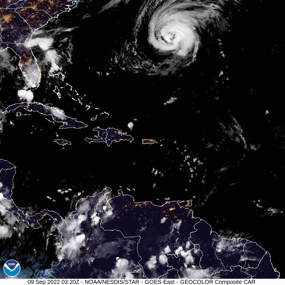
A glancing passage of Hurricane Earl has spared Bermuda the worst effects of the cyclone, even as a tropical storm warning remains in effect on Friday (September 9).
The Bermuda Weather Service, in a 6:15 am update today, urged citizens not to let their guard down despite the island gratefully emerging from the “worst conditions”.
“Good morning Bermuda. Hurricane Earl has passed its closest point of approach, although we’re still under a tropical storm warning until Earl departs the area. We have seen tropical-storm-force winds at most locations, with gusts to 58 knots (67mph) at an elevated site overnight. Preliminary estimates indicate a peak surge was around 1.1ft (36cm) above normal tides late last night, and most areas of the island saw over 1.2 inches (30mm) of rain in the last 24 hours. Although the worst conditions have passed, please continue to monitor conditions at www.weather.bm as Hurricane Earl moves away this morning,” the agency wrote on its Facebook page.
In the meantime, a hurricane watch initially activated on Wednesday has been discontinued for Bermuda.
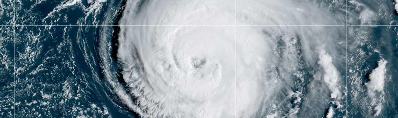
The US-based National Hurricane Center (NHC) pinpointed the centre of Earl near latitude 32.7 North and longitude 62.4 West—or roughly 230 kilometres east-northeast of Bermuda.
According to the NHC latest bulletin, the category two Hurricane Earl is moving at a breakneck, north-northeast pace at 28 kilometres/hour and packing maximum sustained winds of 155 kilometres/hour, with higher gusts.
Computerised projections anticipate Hurricane Earl will keep moving northeastward away from Bermuda today before entering the maritime waters of Newfoundland between Saturday and Sunday.
“Some additional strengthening is forecast through tonight. Earl is expected to complete its transition to a powerful hurricane-force extratropical low on Saturday and then gradually weaken through early Monday,” the agency disclosed.

Satellite observations note that Earl’s wind field continues to grow in size, though it is no longer expected to intensify to major hurricane strength over the weekend.
NHC sleuths indicated that hurricane-force winds extend outward up to 130 kilometres from its centre, while tropical-storm-force winds extend outward up to 335 kilometres.
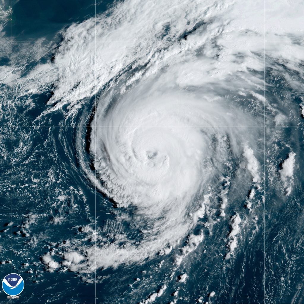
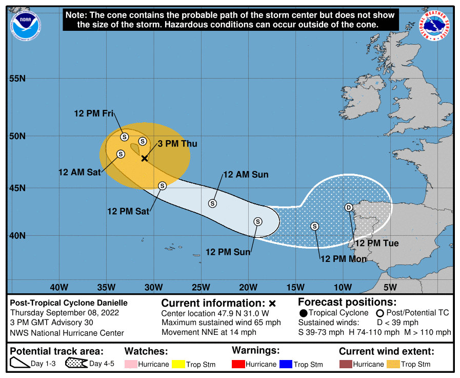
Elsewhere, Danielle, still meandering the colder waters of the north Atlantic Ocean, has been downgraded to a post-tropical cyclone. The NHC, in its last update, said it expected Danielle to “remain a large post-tropical cyclone over the north Atlantic for the next several days, even as its peak winds slowly decrease”.
The system, as at 3:00 pm Greenwich Meridian Time (GMT), was located near latitude 47.9 North and longitude 31.0 West—or some 1,145 kilometres north-northwest of The Azores.
The post-tropical Danielle is barrelling towards the north-northeast at a speed of 22 kilometres/hour while still packing a formidable punch with maximum sustained winds at 100 kilometres/hour.
NHC meteorologists are also actively tracking three other disturbances in the tropical Atlantic with varying potential for further development in the coming days.
The closer low-pressure system, located roughly 1,770 kilometres east of the Leeward Islands, is struggling to keep itself together in the face of unfavourable environmental conditions.
“Although the low has a well-defined centre of circulation, strong upper-level winds have caused most of the disorganised shower and thunderstorm activity associated with the low to be displaced well to its northeast. The strong upper-level winds are forecast to persist for the next several days and it is becoming less likely that a short-lived tropical storm will form,” the NHC said.
The disturbance’s development chances are further stunted by the impact of a fresh plume of Saharan dust, which has seen its formation odds plummet to a “low” 30 per cent over the next two-to-five days.

Continuing its tropical weather outlook, the NHC said that a tropical wave located several hundred miles south of the Cabo Verde Islands is producing a disorganised area of showers and thunderstorms.
“Development of this system, if any, is expected to be slow to occur while it moves westward or west-northwestward across the eastern and central tropical Atlantic through the middle of next week,” the Miami-based agency added.
The likelihood of further development is currently “low” at 20 per cent over the next five days.
Meanwhile, another tropical wave is forecast to move off the coast of Africa by early next week, the NHC advised.

Noting “low” strengthing chances at 20 per cent over the next five days, the hurricane watchdog disclosed that “some gradual development of the wave will be possible after it moves over water and heads generally westward over the far eastern Atlantic”.
The next three names available for the 2022 North Atlantic Hurricane Season are Fiona, Gaston and Hermine.


Comments