Potential Cyclone Two first takes aim at Trinidad and Tobago

Gavin Riley / Our Today
administrator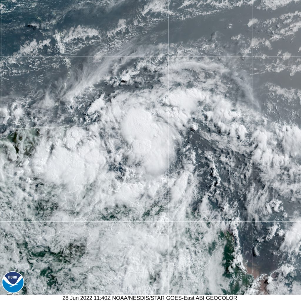
A tropical storm warning has been activated for Trinidad and Tobago as a disorganised but quickly developing system, Potential Cyclone Two, aims for the twin-island republic.
The US-based National Hurricane Center (NHC), in its 5:00 am Atlantic Standard Time (AST) bulletin, says a tropical storm warning has additionally been activated for Grenada.
A tropical storm watch is also in effect for the Caribbean coast of Venezuela from Pedernales to Cumana, including Islas de Margarita, Coche, and Cubagua as well as the Dutch territory of Bonaire.
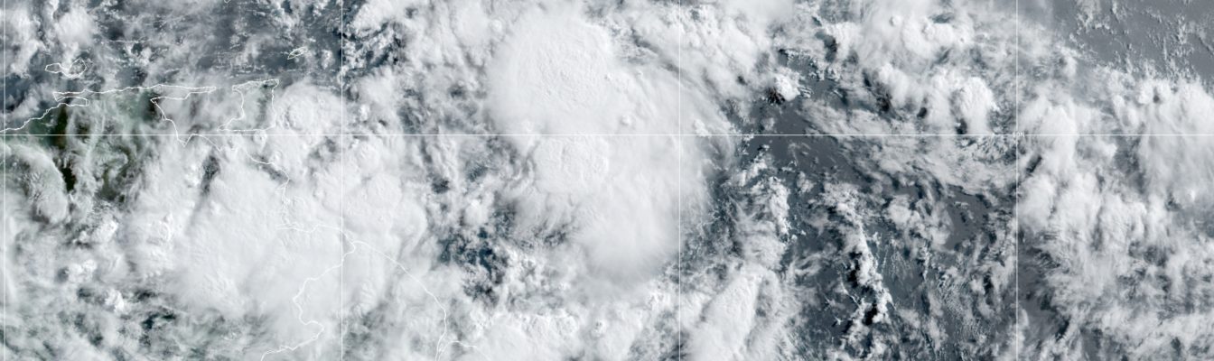
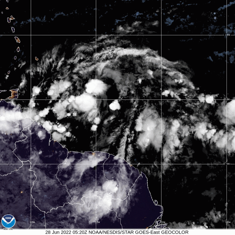
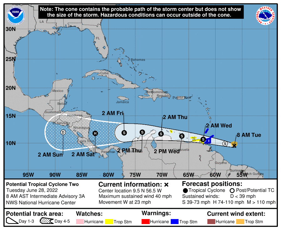
As at 5:00 am AST, the centre of Potential Cyclone Two was located near latitude 9.3 North, longitude 55.2 West—or roughly 680 kilometres east of mainland Trinidad.
The system is barreling west at 37 kilometres/hour and packing maximum sustained winds of 65 kilometres/hour, with higher gusts.
On the forecast track, meteorologists at the NHC are projecting the system will pass near or over portions of the southern Windward Islands by tonight, bringing heavy rains and strong winds.
The cyclone is then expected to move over the southern Caribbean Sea or near the northern coast of Venezuela on Wednesday and Thursday.
Islands as far north as Guadeloupe through to St Lucia are in store for isolated rainfall up to a maximum of three inches (76.2 millimetres). For St Vincent and Barbados, the upper limit of rainfall activity could reach as high as five inches (127 mm), while conditions in Grenada, Trinidad and northeastern Venezuela could peak at six inches (152.4 mm).
Sleuths at the NHC maintain that slight strengthening of Potential Cyclone Two is highly likely during the next few days if the disturbance remains over water.
“Conditions appear conducive for development if the disturbance remains over water, and it will likely become a tropical storm near the southern Windward Islands or while moving westward across the southern Caribbean Sea,” the NHC bulletin indicated, adding that development chances remain high at 90 per cent over the next five days.
Current projections estimate that the system could intensify into Tropical Storm Bonnie by as early as 2:00 am Wednesday, strengthening further into a hurricane by Saturday before a direct hit with Nicaragua.
For its part, the Jamaica Meteorological Service has indicated that Potential Cyclone Two does not pose a direct threat to the island. The Met Service also assured the public that it will continue monitoring the system’s progress through the Caribbean Basin.
Further east in the open Atlantic, much remains unchanged for the second tropical wave.
The NHC noted that the system of disorganised showers and thunderstorms is expected to interact with another tropical wave to its east over the next several days, and some gradual development is possible later this week while the overall disturbance moves west-northwestward at around 24 kilometres/hour across the central tropical Atlantic.
Formation probability is still ‘low’ at 20 per cent over the next five days.
Closer still, the NHC is also tracking an area of low pressure centred over the northwestern Gulf of Mexico.
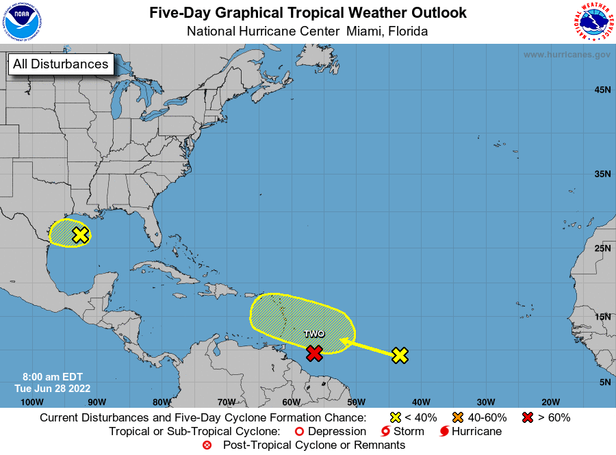
“Shower and thunderstorm activity associated with the low has increased overnight but remains disorganised. Some additional development of this system is possible as it moves slowly westward
or west-southwestward and approaches the coast of Texas during the next two days. Regardless of development, heavy rain will be possible along portions of the Texas coast later this week,” the hurricane watchdog advised.
READ MORE:
- Eastern Caribbean on alert as ‘organising’ tropical wave inches closer
- NHC sleuths now monitoring three systems in tropical Atlantic


Comments