
Tropical Storm Ida whips Cayman, flash flood warning still in effect for Jamaica

Gavin Riley / Our Today
administrator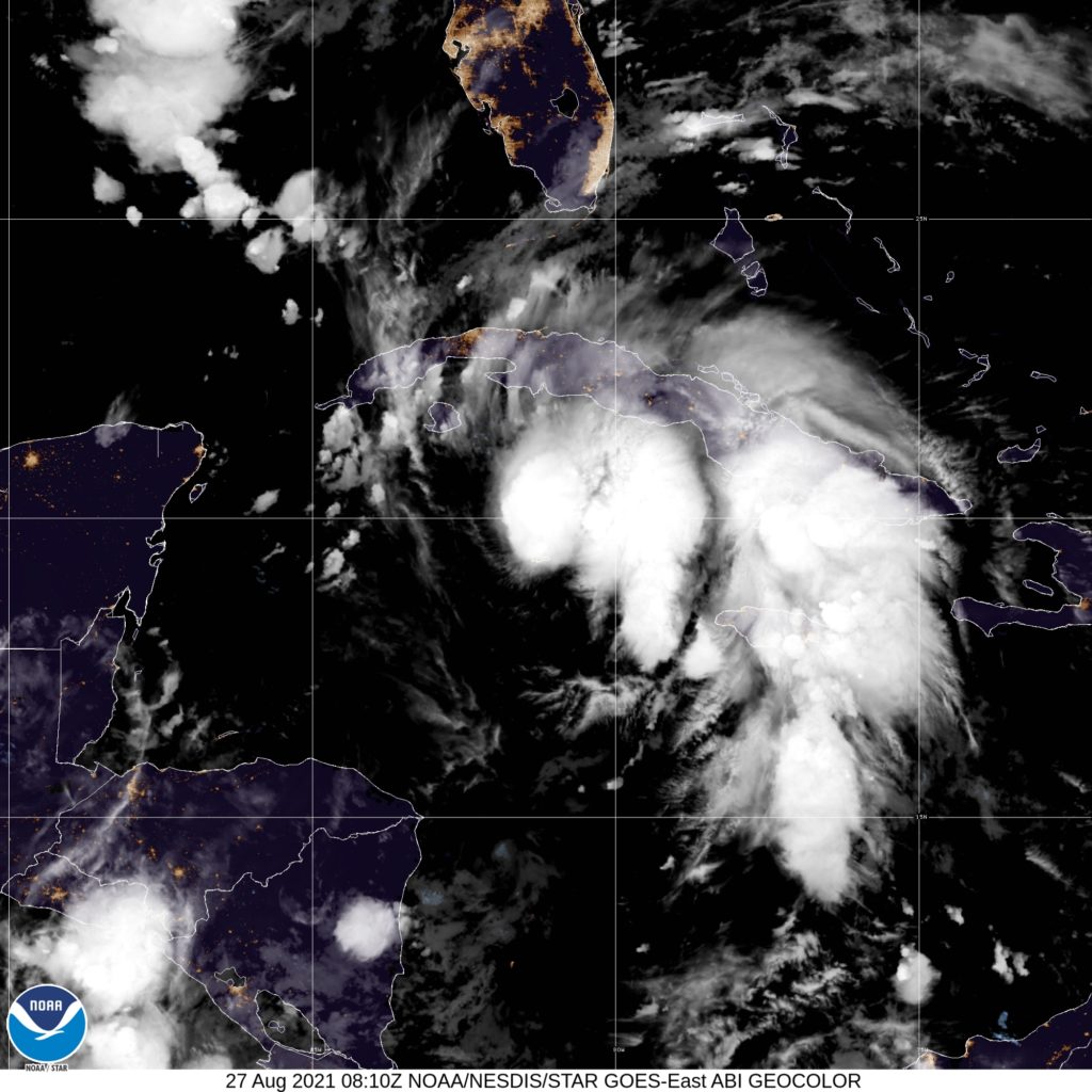
The US-based National Hurricane Center (NHC) has issued its highest warning yet on Friday (August 27) as Tropical Storm Ida continues to strengthen in the Caribbean Sea.
In the meantime, Jamaica’s Meteorological Service indicated that the flash flood warning activated for low-lying and flood-prone areas of the island remains in effect until 5:00 pm local time.
Ida’s outer bands, where tropical-storm-force winds extend outward up to 130 kilometres from its centre, will persist as the dominant weather influence well into Saturday, the agency added.
As at 5:00 am Eastern Standard Time (EDT), the centre of Tropical Storm Ida was located near latitude 20.0 North, longitude 81.4 West—smack on Grand Cayman island.
Ida, the ninth named storm of the 2021 North Atlantic Hurricane Season, is moving northwest 24 kilometres/hour and packs maximum sustained winds at 75 kilometres/hour, with higher gusts.

Forming from Tropical Depression Nine, Ida swelled in size and roared into tropical storm status at 5:20 pm EDT on Thursday, weather sleuths at the NHC noted.
The NHC, in its 5:00 am EDT advisory, said additional steady-to-rapid strengthening is expected during the next few days.
“Ida is forecast to become a hurricane over the southeastern Gulf of Mexico in a day or two, and to be at or near major hurricane strength when it approaches the northern US Gulf Coast,” the Miami-headquartered hurricane watchdog said.
Breakdown of storm watches and warnings below:
- Storm surge watch: Sabine Pass to Alabama/Florida border. Vermilion Bay, Lake Borgne, Lake Pontchartrain, Lake Maurepas, and Mobile Bay.
- Hurricane watch: Cameron, Louisiana to the Mississippi/Alabama border. Lake Pontchartrain, Lake Maurepas, and Metropolitan New Orleans.
- Tropical storm warning: Cayman Islands. Cuban provinces of Matanzas, Mayabeque, Havana, Artemisa, Pinar del Rio, and Isla de la Juventud
- Tropical storm watch: Mississippi/Alabama border to the Alabama/Florida border.
Isolated maximum rainfall accumulation in Jamaica could reach as high as 15 inches, 20 inches in the Cayman Islands and western Cuba, which can potentially trigger flash flooding life-threatening mudslides, the NHC forecast added.

On the forecast track, Tropical Storm Ida is expected to gradually move away from the Cayman Islands later this morning, pass near or over Isla de la Juventud and western Cuba later today, and over the southeastern and central Gulf of Mexico tonight and Saturday.
The system is forecast to approach the US northern Gulf Coast on Sunday as a menacing hurricane.


Comments